
Image produced from the Ordnance Survey Get-
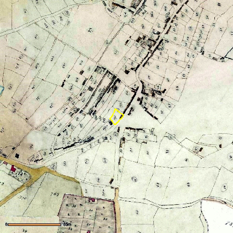
Image reproduced with the kind permission of the Senior Archivist of the Cheshire and Chester Archives and Local Studies. Grid Ref SJ 766875, tithe map reference EDT 13/2.
URL http://maps.cheshire.gov.uk/tithemaps/TwinMaps.aspx?township=EDT_13-
Tithe map of 1835 centred on plot 190 (shown edged in yellow), the site that would become the Downs Hotel.
Current (2009) Ordnance Survey map of Altrincham centred on the Downs Hotel at a similar scale to the tithe map on the left.